

 Update")
Overcast skies and muggy conditions will continue ahead of a developing low-pressure system tonight. Lows will only fall into the upper 60s to near 70s with south winds 10 to 15 MPH and gust 25 to 30 MPH.
During the late morning, a cold front from the north will generate scattered showers over southeast Texas and southwest Louisiana. These will stream overhead into the early afternoon. As the day moves into the afternoon and early evening, showers may strengthen into thunderstorms with all hazards (damaging winds, hail, and isolated tornadoes) possible. Ahead of the front, temperatures will warm into the low 80s with strong southerly winds 15 to 25 MPH and gust up to 45 MPH.
A Potential Risk for severe thunderstorms exists on Friday afternoon into evening, ranging from a Marginal (level 1 out of 5) to Slight (2 out of 5) to Enhanced (3 out of 5.) The potential risk is for all storm hazards (damaging straight-line wind gusts, large hail, tornadoes.)
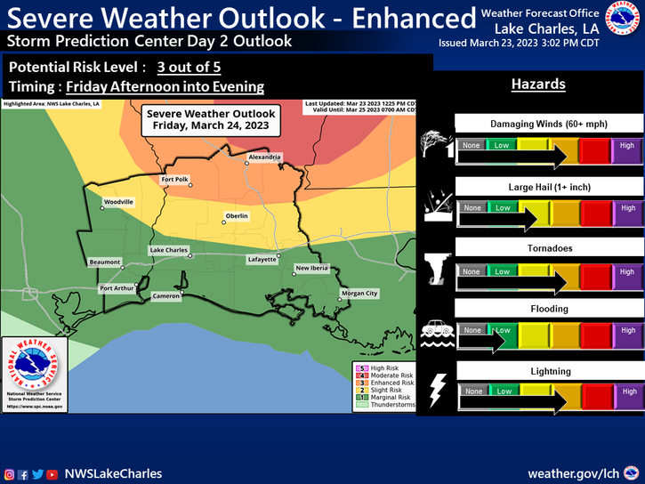
Isolated supercell storms may develop during the afternoon across the area. These storms will eventually evolve into a line ahead of a cold front that will cross during the evening hours.


 Update)